 Final Full Fatal Crash Report
Reference Number:
CRMS8000142073 / TREIS Ref:422749
This report is written to comply with Clause 5.5.6 of the BOPW Joint
NZTA/WBOPDC One Network Maintenance Contract Contract No: NZTA
2/14-002/601. This report is required to address issues such as the
Purpose of this Report:
location and possible factors contributing to the crash, weather
conditions and road conditions; be the most complete representation
possible of the crash; recommend any remedial actions.
Type of Crash:
Fatal
s 9(2)(a)
(WestLink) advised the Melissa Clare (Waka Kotahi) via
Advice to Principal
phone at 16:39 and advised s 9(2)(a)
(MCM) via text at 16:55.
Crash Location
SH 2: 130/7.71 (Speed limit 80km/h. AADT16 260vpd)
Notified
Date of Crash
28/4/23
28/4/23
Date
Notified
Time of Crash
16:15
16:24
Time
Number of Vehicles
2
involved
Vehicle 1: Over dimensional haulager
Vehicle Type
Vehicle 2: Pushbike
Vehicle 1: Increasing, (eastbound)
Direction of Travel
Vehicle 2: Increasing
Injury Severity
1* Fatal
s 9(2)(a)
Description of Crash
under the Official Information Act 1982
Released

 Final Full Fatal Crash Report
s 9(2)(a)
Environmental
Fine, daylight, sunny.
Conditions
Road Condition
Dry, sealed.
s 9(2)(a)
Possible Causes
Damage to assets
Minor damage to the seal from the bike’s quick release mechanism.
Repair Work Required
Nil. Site was washed down by FENZ.
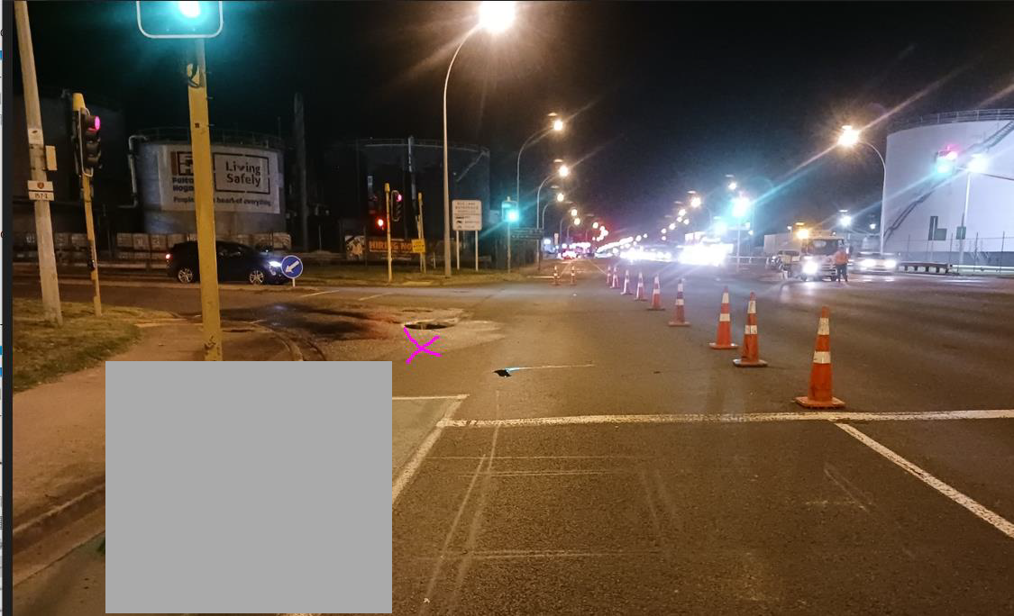
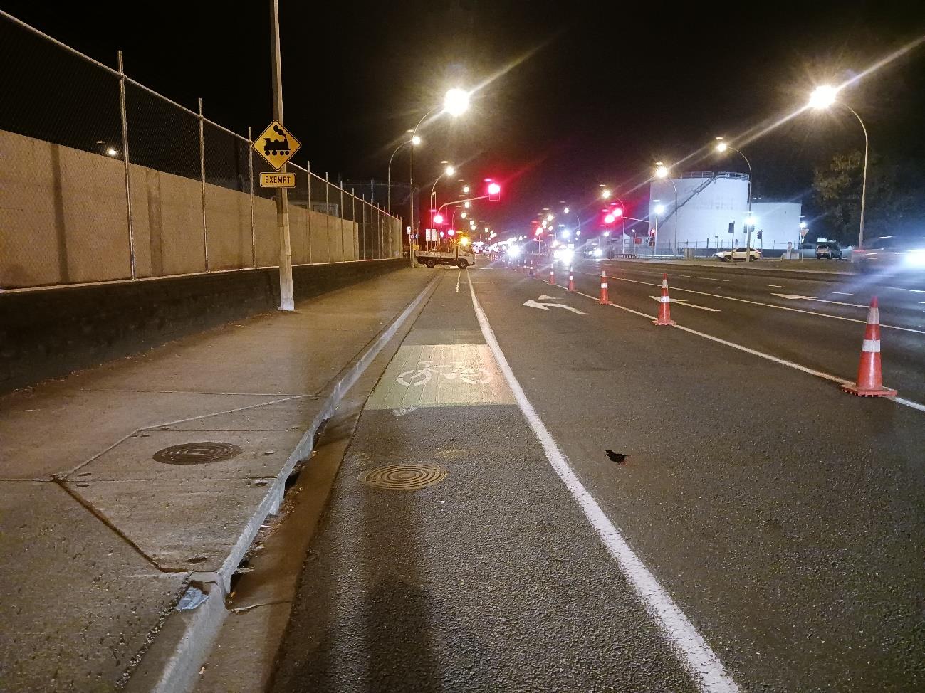
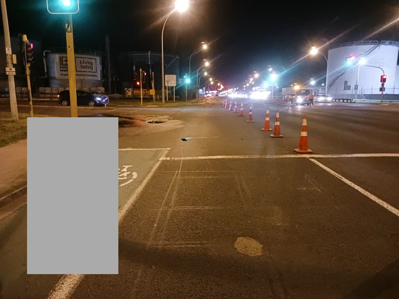
LHS: Footpath, non-mountable kerb and channel, intersection
(immediately preceded by marked cycle lane and left/through traffic
lane).
Cross-section at Point
of Impact
s 9(2)(a)
under the Official Information Act 1982
Looking in the Increasing Direction at the crash site (approximate
collision point is shown by the pink cross.
Vertical Geometry
Essentially flat
Horizontal Geometry
Straight, but Vehicle 1 was turning 90 degrees to the left into Tasman
Quay.
Junction Control
Signalised.
Released
Speed Limit
s 9(2)(a)
Was Speed a
70km/h
factor?

 Final Full Fatal Crash Report
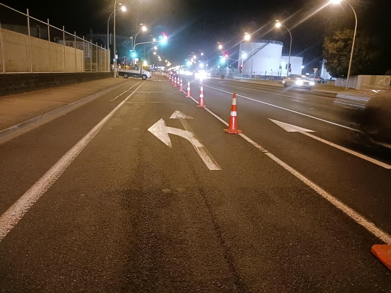
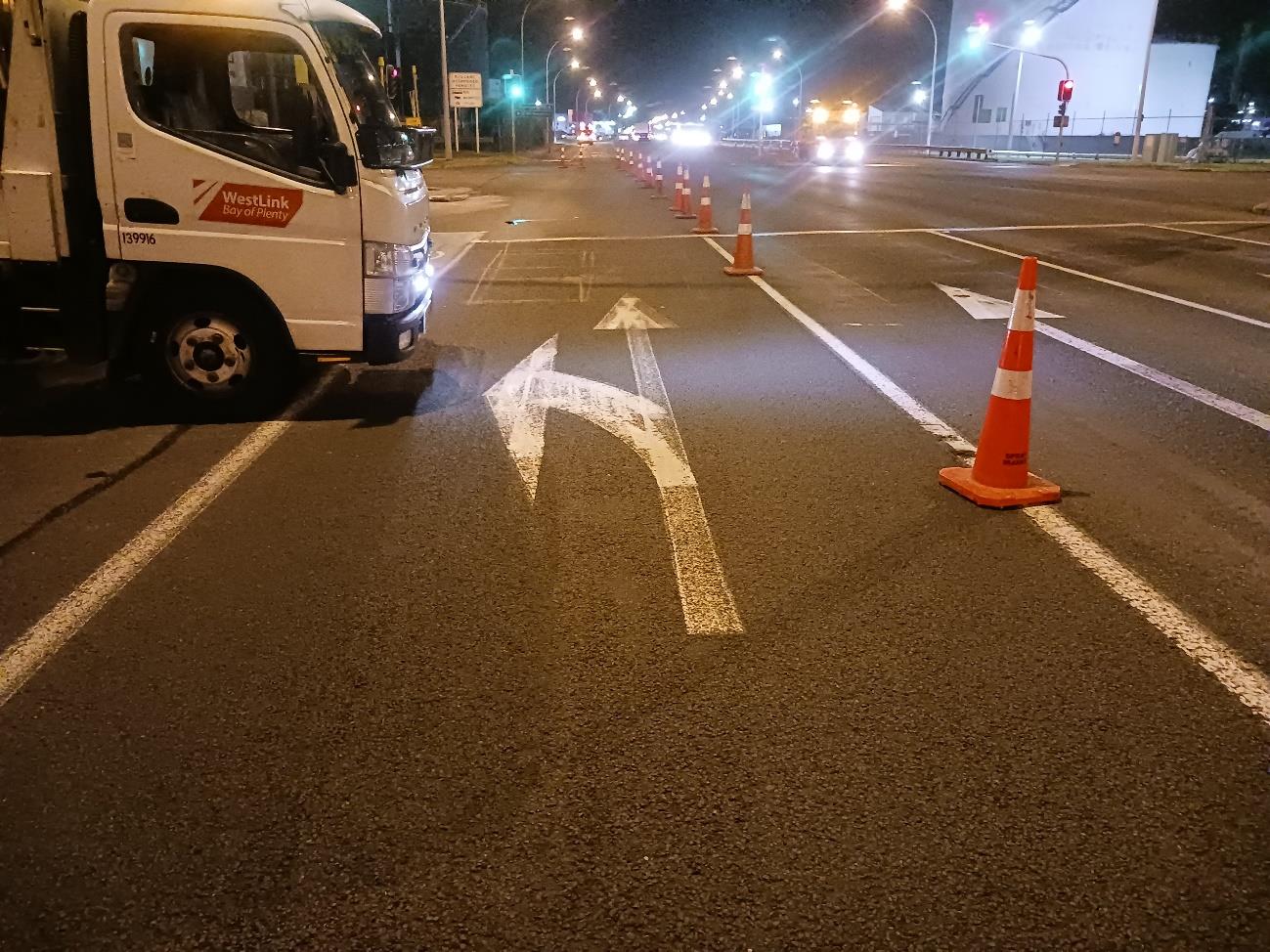
Pavement Markings
Marked cycle lane
Vehicle lane line markings
Limit lines
Lane assignment arrows in the vehicle lanes
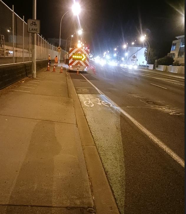
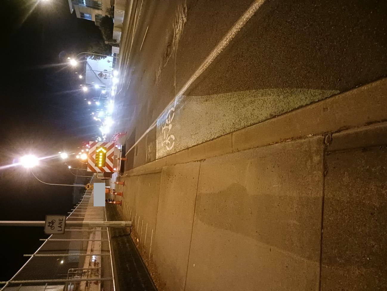
There is a cycle lane sign in the footpath adjacent to the cycle lane.
Signage
Looking in the Increasing Direction at the dropdown from the Shared
Path to the on-road cycle lane
Surface
SMA September 2007. Programmed for TAC September 2023.
Full route lighting, all working.
Signals were operational during the site visit on the night of the crash.
Phasing is:
• Green roundel
Lighting
• Amber roundel
• Red left turn arrow and Red roundel
under the Official Information Act 1982
• Green left turn arrow and Red roundel
• Green roundel
Crash History
There are 23 recorded crashes within 100m of the crash site in the last 5
years plus 2023 to date. None of them involved a cyclist. Crash records
are attached.
Road Factors Involved
The cycle lane is marked up to the limit line to the left of a left turn lane.
Conclusions
s 9(2)(a)
Released

 Final Full Fatal Crash Report
s 9(2)(a)
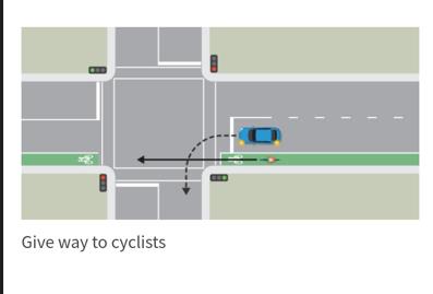
The link to the relevant page of the Road Code is here:
The give way rules | Waka Kotahi NZ Transport Agency (nzta.govt.nz)
s 9(2)(a)
Intersections with turning traffic are particularly hazardous for cyclists due
to the potential for drivers to turn across a cyclist and because the cyclist
is unprotected, the resulting injuries are often serious.
Hewletts Road carries around 50 000vpd with around 5 000 HCVs per day.
Therefore, conflict between cyclists and heavy vehicles is expected,
under the Official Information Act 1982
particularly where cyclists have to be on the road and where their lane
intersects with turning or lane changing/addition.
The road layout could be reconfigured so that the cycle lane is physically
separated from the vehicle lane and the through cyclists aren’t in conflict
with the left turning vehicles but if Waka Kotahi want to do this, careful
consideration to the residual risks is required. The left turn lane would
be hard left up against the kerb so cyclists would have to cross this but
this can be done in a controlled and safe way. However, ultimately,
Released having cyclists on-road in a high volume, high HCV corridor carries risk
Recommendations
and consideration as to whether an on-road cycle lane here is a ‘want’ (ie
borne from thinking that real cyclists won’t use an off-road path anyway)
rather than a ‘need’, particularly when considering whether the setup is a
safe system. Sometimes, requiring a person on a bike to stop and give
way to turning traffic is best for overall corridor efficiency and for
elimination of conflict. If a person wants to ride in the traffic lane despite
a functional off-road facility being available, that is their choice, but they

 Final Full Fatal Crash Report
will do so knowing that they are taking their place in the vehicular lane
without the false sense of security that is afforded by the existing lane.
There is a high demand for cycling on Hewletts Road. The alternative
route via Totara Street South is somewhat isolated and does not have
the passive surveillance that Hewletts Road does. Accordingly, it is
appropriate to provide safe, separated cycle space on Hewletts Road to
cater for the existing, the supressed and the future cycling demand.
Short term:
We recommend that Waka Kotahi should consider removing the on-road
cycle lane from 151/6.04 to 151/6.14 here completely and replace the
drop crossing with standard kerb and channel because cyclists are
already allowed to stay on the separated path here. (Note that this
crossing already has a cycle lantern display with associated call button).
The work required to achieve this is minimal – black out the cycle lane
markings and reinstate the kerb – so it is low cost, and could be done
within a few weeks
If instead, Waka Kotahi choose to leave the on-road cycle lane in place,
the signage for the separated path should be reviewed as it is not
obvious that the path is able to be legally used by cyclists. There is one
‘cycle lane’ sign that is just beyond the drop crossing but it is ambiguous
as to whether it refers to the path (which looks like narrow footpath) or
the adjacent cycle lane. The path should be marked as Shared Path.
Again, this is work is low cost.
Longer term:
The path along this length should be widened to enable pedestrian use
and comfortable two-way cycling, irrespective of whether the on-road
cycle lane is retained, so that there is a safe, separated option. The
crossing at Tasman Quay can be upgraded to better suit cyclists. This is
not high cost work – additional kerb and channel and concrete infill,
modify the lead in to the crossing and add hold rails.
We recommend talking to the Port to determine whether the left turn into
Tasman Quay is required for their operations. If the left turn can be
under the Official Information Act 1982
eliminated, this would eliminate the conflict for cyclists. The intersection
could then be modified to prevent the left turn in.
Ultimate:
A comprehensive solution for all of Hewletts Road is recommended to
provide safe, separated cycling.
s9(2)(a)
Report Prepared By:
Date:
17/5/23
Released
Appendix A
Photographs
Appendix B
Map or Aerial Photograph
Appendix C
Crash History
Appendix D
Scrim records
 Final Full Fatal Crash Report
Appendix A: Photographs
Final Full Fatal Crash Report
Appendix A: Photographs
Increasing Direction (both vehicles)
s 9(2)(a)
under the Official Information Act 1982
Released
 Final Full Fatal Crash Report
Appendix A: Photographs
Final Full Fatal Crash Report
Appendix A: Photographs
under the Official Information Act 1982
Released
 Final Full Fatal Crash Report
Appendix A: Photographs
Final Full Fatal Crash Report
Appendix A: Photographs
s 9(2)(a)
under the Official Information Act 1982
Released
 Final Full Fatal Crash Report
Appendix A: Photographs
Final Full Fatal Crash Report
Appendix A: Photographs
s 9(2)(a)
s 9(2)(a)
under the Official Information Act 1982
Released
s 9(2)(a)
 Final Full Fatal Crash Report
Appendix A: Photographs
Final Full Fatal Crash Report
Appendix A: Photographs
s 9(2)(a)
s 9(2)(a)
under the Official Information Act 1982
Released
 Final Full Fatal Crash Report
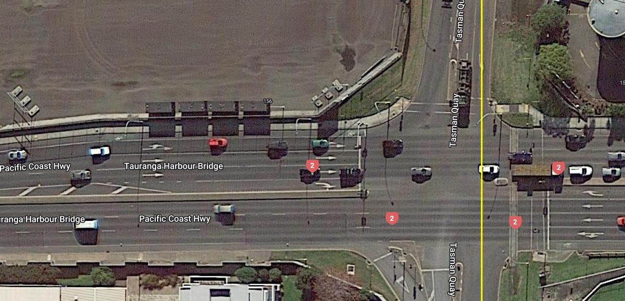
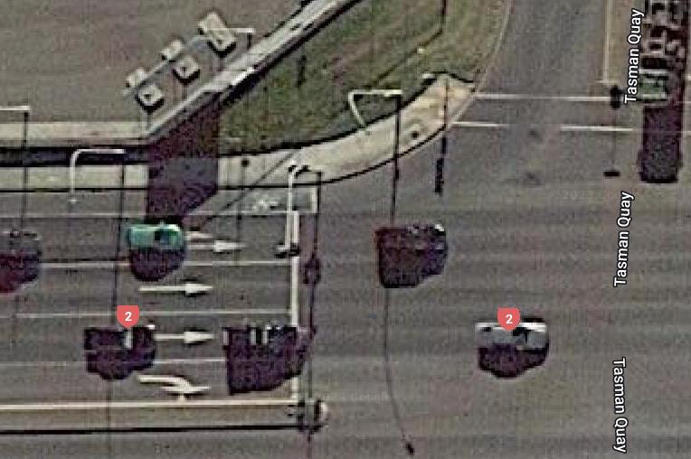
Appendix B: Aerial Photograph
Final Full Fatal Crash Report
Appendix B: Aerial Photograph
Impact Site
SH 2
Papamoa>
V1 (bike)
V2 (Semi-trailer)
SH 2
<Tauranga CBD
under the Official Information Act 1982
Released
 Final Full Fatal Crash Report
Appendix B: Aerial Photograph
Final Full Fatal Crash Report
Appendix B: Aerial Photograph
under the Official Information Act 1982
Released
Final Full Fatal Crash Report
Appendix C: Crash History
Crash road
FEATURE Distance Direction Side road
Easting
Northing ID
Date
Day of week
Time
Surface cond
N i
a tio
turn
al light
Weather Junction Control
Casualty coun
Ca t
s f
u a
alta
tyl coun
Ca t
s s
u e
al ri
tyo
u
c s
ou
S n
o t
ci mi
al no
Co r
st $(m)
002-0151/02.48-D-CO29
5 E
TASMAN QUAY
1880892 5826519
201963441
3/04/2019 Wed
16:40
Dry
Bright sun Fine
Nil (Default)
Unknown
0
0
0
0.03
s 9(2)(a)
002-0151/02.48-D-CO29
56 W
TOTARA STREET
1881066 5826509
201969608
4/06/2019 Tue
15:30
Dry
Bright sun Fine
Nil (Default)
Unknown
0
0
0
0.03
002-0151-I-CO29
1880865 5826532
201898040
30/08/2018 Thu
0:00
Wet
Dark
Light rain T Junction Traffic Signals
0
0
0
0.03
HEWLETTS ROAD
I
TASMAN QUAY
1880905 5826517
2022214719
28/02/2022 Mon
1:25
Dry
Dark
Fine
CrossroadsTraffic Signals
0
0
2
0.1
HEWLETTS ROAD
I
TASMAN QUAY
1880865 5826532
201977471
11/08/2019 Sun
2:20
Wet
Dark
Heavy rainCrossroadsTraffic Signals
0
0
0
0.03
HEWLETTS ROAD
I
TASMAN QUAY
1880875 5826532
2020186403
8/10/2020 Thu
12:10
Dry
Bright sun Fine
CrossroadsTraffic Signals
0
0
0
0.05
HEWLETTS ROAD
I
TASMAN QUAY
1880872 5826532
2023255357
28/04/2023 Fri
16:16
Dry
Bright sun Fine
CrossroadsTraffic Signals
1
0
0
5.85
HEWLETTS ROAD
91 E
TASMAN QUAY
1880974 5826529
2020162348
25/08/2020 Tue
12:00
Wet
Overcast Light rain Nil (Default)
Nil
0
0
0
0.05
HEWLETTS ROAD
35 E
TASMAN QUAY
1880918 5826517
2020156244
10/03/2020 Tue
17:00
Dry
Bright sun Fine
Nil (Default)
Unknown
0
0
0
0.05
HEWLETTS ROAD
I
TASMAN QUAY
1880877 5826532
2022233961
3/09/2022 Sat
0:03
Dry
Dark
Fine
CrossroadsTraffic Signals
0
0
0
0.05
HEWLETTS ROAD
I
TASMAN QUAY
1880887 5826532
2021206820
4/12/2021 Sat
9:10
Dry
Overcast Fine
CrossroadsTraffic Signals
0
0
0
0.05
HEWLETTS ROAD
I
TASMAN QUAY
1880863 5826532
2020178678
14/08/2020 Fri
14:00
Dry
Overcast Fine
CrossroadsTraffic Signals
0
0
0
0.05
HEWLETTS ROAD
I
TASMAN QUAY
1880902 5826518
2020171109
22/11/2020 Sun
23:02
Wet
Dark
Fine
CrossroadsTraffic Signals
0
0
0
0.05
HEWLETTS ROAD
I
TASMAN QUAY
1880899 5826520
2022231581
15/03/2022 Tue
12:15
Dry
Bright sun Fine
CrossroadsTraffic Signals
0
0
0
0.05
HEWLETTS ROAD
I
TASMAN QUAY
1880872 5826518
2020165204
25/09/2020 Fri
16:15
Dry
Bright sun Fine
T Junction Traffic Signals
0
0
0
0.05
HEWLETTS ROAD
55 E
TASMAN QUAY
1880938 5826528
2022225326
27/05/2022 Fri
18:35
Dry
Dark
Fine
Nil (Default)
Nil
0
0
0
0.05
HEWLETTS ROAD
I
TASMAN QUAY
1880896 5826517
2020173389
13/12/2020 Sun
5:30
Dry
Bright sun Fine
T Junction Traffic Signals
0
0
0
0.05
HEWLETTS ROAD
72 W
TOTARA STREET
1881048 5826525
201898610
5/10/2018 Fri
13:00
Dry
Bright sun Fine
Nil (Default)
Nil
0
0
0
0.03
under the Official Information Act 1982
HEWLETTS ROAD
90 W
TOTARA STREET
1881030 5826512
2021181072
11/03/2021 Thu
19:05
Dry
Bright sun Fine
Nil (Default)
Unknown
0
0
0
0.05
HEWLETTS ROAD
84 W
TOTARA STREET
1881038 5826526
201982224
2/10/2019 Wed
17:30
Wet
Overcast Light rain Nil (Default)
Unknown
0
0
0
0.03
SH 2
70 W
TASMAN QUAY
1880815 5826531
201841415
5/06/2018 Tue
15:20
Wet
Overcast Fine
Nil (Default)
Unknown
0
0
0
0.03
SH 2
80 W
TASMAN QUAY
1880805 5826531
201836874
5/04/2018 Thu
7:40
Dry
Bright sun Fine
Nil (Default)
Unknown
0
0
0
0.03
SH 2
70 E
TASMAN QUAY
1880955 5826529
201831672
3/02/2018 Sat
15:30
Dry
Overcast Fine
Nil (Default)
Unknown
0
0
0
0.03
TASMAN QUAY
67 N
HEWLETTS ROAD
1880886 5826599
2022226562
22/06/2022 Wed
7:50
Dry
Bright sun Fine
Nil (Default)
Nil
0
0
0
0.05
Released
Final Full Fatal Crash Report
Appendix D: Scrim Records
n/a – truck was turning left on dry road. Area where the cycle might have braked isn’t measured.
under the Official Information Act 1982
Released