Magazine & Emulsion Tank
J012082_Emulsion Tanks 2025 (1).pdf
Purpose
To assess the presence and nature of any archaeological or heritage features within the proposed location for a magazine and emulsion tank
associated with the Bendigo-Ophir Gold Project (BOGP) in Bendigo, Central Otago. The assessment was commissioned by Santana Minerals Ltd and
conducted by New Zealand Heritage Properties Ltd (NZHP).
Findings
No previously recorded archaeological sites are present within the project area.
Desktop appraisal using LiDAR, historical aerials (1958), survey maps, and geological plans did not identify any heritage features.
Pedestrian survey conducted on 14 March 2025 confirmed:
-
No archaeological or heritage features within the tank footprints.
-
All visible linear features were stock tracks or plough marks.
-
Fences and culverts in the area are modern.
The closest recorded archaeological sites are approximately 500m southwest of the project area and include pastoral/agricultural and gold mining
sites.
Recommendations/
1.Proceed without archaeological authority:
Mitigations
- Matakanui Gold Ltd can proceed with construction of the magazine and emulsion tank.
2.Accidental Discovery Protocol:
- If any potential archaeological features are discovered during works, all activity must stop and NZHP must be contacted immediately.
3.Contractor Briefing:
- All contractors should be briefed on how to identify archaeological materials and the appropriate response if encountered.
4.Further Works:
- Any future works beyond the current scope should be reassessed by an archaeologist to evaluate potential impacts on heritage features.
Released under the Official Information Act

s9(2)(a)
New Zealand Heritage Properties Ltd
Salisbury House
106 Bond St,
Dunedin, 9016
s9(2)(a)
Santana Minerals Limited
105 Bendigo Loop Road, Bendigo
17/04/2025
Re: Ardgour Rise Realignment April 2025
Dear s9(2)(a)
New Zealand Heritage Properties Ltd (NZHP) has been commissioned by Matakanui Gold Ltd (MGL) to identify
the presence and nature of heritage sites within the proposed Ardgour Rise road realignment, Bendigo (Figure 1).
Resources that have been consulted for the desktop appraisal include LiDAR, the New Zealand Archaeological
Association Archaeological site recording scheme, historical aerials, historic survey maps and geological plans
(review took place in April 2025). Pedestrian surveys of the project area were undertaken by s9(2)(a)
, s9(2
, s9(2)(a)
and s9(2)(a in December 2018, s9(2)(a)
and s9(2)( in April 2024 and
)(a)
s9(2)(a)
in March 2025. )
a)
The following letter outlines that there are no previously recorded archaeological sites present within the area
appraised. All points of interest (POI) identified from a review of LiDAR data and historical aerials from 1958
were identified as natural or stock tracks during the pedestrian surveys. The pedestrian survey did not identify any
other potential heritage features.
This letter concludes MGL can proceed with the proposed Ardgour Rise
road realignment without an archaeological authority but subject to the proposed conditions to mitigate
any potential effects including accidental discovery protocol.
Appraisal
While the history of the wider Bendigo area is associated with historic mining, there are no previously recorded
archaeological sites within the proposed Ardgour Rise road alignment. The vast majority of archaeological sites
recorded nearby (see Figure 1) are situated within the nearby Rise and Shine Creek valley, with a smaller number
in the neighbouring Shepherds Creek valley (Crawford, 1907). Historically, the target area formed part of Run 238
(also known as the Morven Hills Station), first granted to the McLean family in 1858. The run extended from the
Lindis Pass in the north to the Cromwell Gorge in the south (Hamel, 1993). In 1888, the run was subdivided into
several smaller runs, forming Ardgour Station (Evening Star, 1882). The project area is associated with Run 238A,
subdivided again in 1910 when it was renamed Run 238K. There are no heritage features documented on these
historical plans. The Rise and Shine valley was an area of intensive gold mining by the Rise and Shine Company
Released under the Official Information Act
from the 1860s to the 1890s, and the Shepherds Creek valley saw smaller scale mining around the same time
(Carpenter, 2012), but the there is no evidence of mining activity in the valleys north of Shepherds Creek. An aro
tawhito (traditional travel route) passed over Thomsons Saddle to the east of the target area and was used by
manawhenua to pass from the east coast to the central lakes area. The exact route of this ara tawhito is unknown,
1

but it was likely flexible based on weather conditions and vegetation, so may have utilised any of the creek valleys
to the west of the saddle.
The southern end of the proposed alignment abuts the recorded extent of the pre-1900 Matakanui-Bendigo Road
(site G41/782). The Matakanui-Bendigo Road was first officially surveyed along the Shepherds Creek valley in
1898 (SO 12016). Historical research indicates that the idea of the Matakanui-Bendigo Road had been proposed
from at least 1896, with £300 allocated for the survey of the road that year (Otago Witness, 1896). While the first
official survey occurred in 1898, it was estimated the total cost of the road between the Lindis Crossing and
Matakanui would be £8742 14s, with the specific Bendigo to Matakanui portion costing £600 (Cromwell Argus,
1898). There was possibly an earlier track along this route at this time with one article stating that individuals had
“travelled the road” and for the year of 1898, £600 had been allocated to the road’s construction (Cromwell Argus,
1898). Further money for the road was sought by the Vincent County Council in August, 1899 (Cromwell Argus,
1899). Historical newspaper articles suggest that extensive works to form a wide track passable by more substantial
transportation did not occur until after 1900. The government invested money into the construction of the road
so that it was fit for dray traffic in 1902 (Dunstan Times, 1902).
The wide road cutting into the natural hillside, and formed with culverts and revetments, is visible in a 1958 aerial
photograph (Figure 2). However, following a large 140m revetment approximately 5km to the northwest of where
the road abuts the proposed Ardgour Rise route, the road is no longer visible and a current road, continuing
downhill into Shepherds Creek, was installed after this date. The narrower track continues uphill and was formed
in the last 15-20 years. It is unclear if this followed a similar earlier route. There was no evidence of stone
revetments or culverts along this track. The abrupt end to the wider road, suggests that investment into the upgrade
to this Matakanui-Bendigo Road stopped rather suddenly. Perhaps the Thompsons Gorge Road following the Rise
and Shine Creek to the south became more important with contracts issued for portions of this road by the Vincent
County Council in 1903 (Dunstan Times, 1903).
The southern end of the proposed route also ends close to site G41/638 (an agricultural/pastoral site). This site
records a fence line and holding pen also noted on a 1909 plan (SO 1204) as a post standard and five wire fence.
The fence line and holding yard was first recorded during a 2011 archaeological survey (Briden & Schmidt, 2012).
The fence runs along the Thomsons Saddle northeast-southwest. Today, the materials of the original nineteenth
century fence line are still visible in good condition; however, as noted by Briden and Schmidt (2012), modern
maintenance has required the addition of new standards, wire and deer netting. The metal standards of the holding
pens on Thomsons Saddle run at right angles to the road, originally recorded at NZTM E1320691, N5014692
along the fence line. These features will not be impacted by the proposed works.
The next closest recorded archaeological sites are located approximately 400m south of the proposed alignment,
on the floor of the Shepherds Creek valley. This includes G41/785 (gold – mining), G41/786 (gold – mining) and
G41/789 (gold – mining).
The pedestrian survey did not identify any potential heritage features that may be impacted by the proposed works.
All linear features on the historic aerials and LiDAR were confirmed as stock tracks, and all fences were modern
post and wire. Part of the proposed route includes a modern farm track, construction of which has involved some
cutting and benching along the ridge line.
Recommendations
This appraisal has examined the proposed alignment of the Ardgour Rise road with a view to identify the presence
of any heritage features. No archaeological or heritage features have been identified in the project area. Based on
this appraisal NZHP makes the following recommendations:
1. Matakanui Gold Ltd can proceed with the proposed Ardgour Rise road realignment without an
archaeological authority.
a. Should potential archaeological or heritage features be encountered, all works must stop in the
Released under the Official Information Act
vicinity of the find and NZHP contacted (refer to Accidental Discovery Protocols attached to
this letter).
b. Works must not impact the pre-1900 fence along Thomsons Saddle (G41/638)
2


2. A contractor briefing should be given to all parties working on the project to ensure they are able to
identify archaeological material and features in order to avoid them and how to recognise them should
they be encountered unexpectantly.
3. If further exploration or mining is beyond the scope of works described here, further assessment by an
archaeologist of the impact of the proposed works on recorded or unrecorded archaeological remains or
other heritage features is recommended.
Regards,
s9(2)(a)
s9(2)(a)
New Zealand Heritage Properties p. (03) 477 3933 ︱ f. (03) 477 3928
Salisbury House, 106 Bond Street, Dunedin 9016, NZ
http://www.heritageproperties.co.nz
References
Briden, S., & Schmidt, M. (2012).
Historic Resources on Matakanui PL.
Carpenter, L. (2012).
The Rise and Shine Water Race Bendigo, Central Otago.
Crawford, R. J. (1907).
Geological Map of Wakefield Survey District (to accompany Bullentin No 5 Cromwell Subdivion, Western
Otago Division.
Cromwell Argus. (1898).
Upper Clutha Farmers’ Club. Issue 1540, 15 November 1898, Page 5.
Cromwell Argus. (1899).
Maniototo Jottings. Issue 1590, 12 August 1899, Page 2.
Dunstan Times. (1902).
Matakanui-Bendigo Road. Issue 2142, 5 August 1902, Page 5.
Dunstan Times. (1903).
Official Gazette of the Vincent County Council. Issue 2165, 20 January 1903, Page 4.
Evening Star. (1882). Page 4 Advertisements Column 4. In
Evening Star (p. 4). Evening Star.
Hamel, J. (1993).
The rich fields of Bendigo. Department of Conservation.
Otago Witness. (1896).
Bendigo to Matakanui. Issue 2230, 26 November 1896, Page 23.
Released under the Official Information Act
3

s9(2)(ba)(i), s9(2)(b)(ii)
Released under the Official Information Act
4

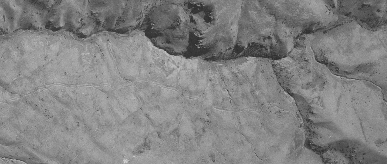
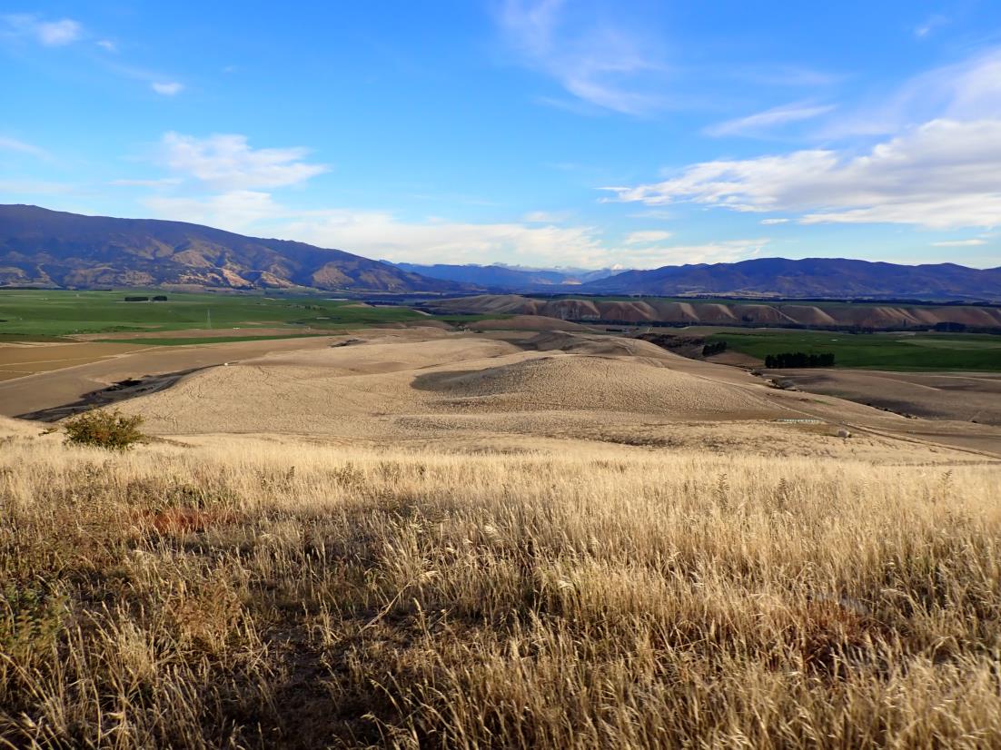
 Figure 2. Aerial photograph from 1958 showing the Matakanui- Bendigo Road (Retrolens, 2021). Note that following the main
stone revetment (red arrow) the wide road is no longer visible.
Figure 3. Looking north towards northern end of prosed route, March 2025.
Figure 2. Aerial photograph from 1958 showing the Matakanui- Bendigo Road (Retrolens, 2021). Note that following the main
stone revetment (red arrow) the wide road is no longer visible.
Figure 3. Looking north towards northern end of prosed route, March 2025.
Released under the Official Information Act
5

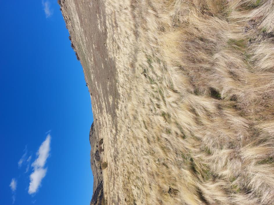
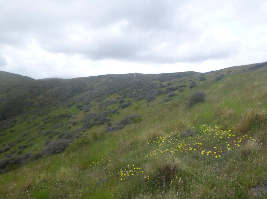 Figure 4. Looking west along proposed road route, approximately in centre of route.
Released under the Official Information Act
Figure 5. Looking northeast towards southern end of proposed route (note existing track along ridge), December 2018.
6
 Accidental Discovery Protocol
YES
Accidental Discovery Protocol
YES
Secure the site to a 20m
Aukaha will arrange a site
radius (as practical) to
inspectio
n by the appropriate
ensure that the remains
manawhenua and their
are safe (cordon this off
advisers, including statutory
1) Manawhenua will be provided sufficient time to perform
with tape or by some
agencies, who will determine
other measure). Work
appropriate rituals and customary practices.
how the situation will be
must cease on the project
appropriately managed in
outside this area. No
accordance with tikanga
2) Archaeological recording will be undertaken in accordance with the
photographs must be
māori.
outcome of consultation. The archaeolgist will contact the Ministry for
taken, no communication
Culture and Heritage if artefacts are removed from the find site.
with media.
Consultation between
Aukaha, Heritage New
3) Work can recommence once iwi, NZHP, and Heritage New Zealand
Call the NZHP
Zealand, NZHP, public health
are satisfied. An archaeological authority may be required to proceed
Suspected
immediately. NZHP will
unit, and authority holder
with work.
archaeological
assist you in contacting
about the level of recording,
material encountered
Aukaha, Heritage New
removal protocols, and
Zealand, and the police.
reburial.
Are human remains
* STOP WORK *
present (or suspected
(if the remains appear
1) Manawhenua will be provided sufficient time
to be)?
recent, police have
to perform appropriate rituals and customary
The contractor must
jurisdiction as a possible
practices.
shut down all
crime scene)
Call Project Manager,
machinery, and
who will contact
secure the area.
NZHP.
2) Archaeological recording will be undertaken in
NO
accordance with the outcome of consultation.
Māori archaeology
NZHP will assist the
The archaeolgist will contact the Ministry for
Secure the site to a 20m
contractor to contact
Culture and Heritage if artefacts are removed
radius (as practical) to
all relevant parties,
from the find site.
ensure that the
including iwi and
archaeological materials
Heritage New Zealand.
3) Work can recommence once iwi, NZHP, and
are safe (cordon this off
Heritage New Zealand are satisfied. An
with tape or by some other
archaeological authority may be required to
measure). Work can
proceed with work
continue outside of the
Call Project Manager
area.
who will call NZHP
1) Archaeological recording will be undertaken in
accordance with the outcome of consultation
Call NZHP immediately.
NZHP will assist the
with Heritage New Zealand
Send a photo of the
contractor to contact
artefact/feature to NZHP,
European Archaeology
relavant parties, such
who will advise on further
as Heritage New
2) Work can recommence once NZHP and
requirements.
Zealand
Heritage New Zealand are satisfied. An
archaeological authority may be required to
proceed with work.
Emergency Contact Details
NZHP (New Zealand Heritage Properties; contract archaeologist)
New Zealand Heritage Properties Office
Phone: 03 477 3933
s9(2)(a)
s9(2)(a)
Heritage New Zealand Pouhere Taonga (government
agency)
Released under the Official Information Act
s9(2)(a)
Tankata Whenua Contact
Aukaha
Phone: 03 477 0071
7

s9(2)(a)
New Zealand Heritage Properties Ltd
Salisbury House
106 Bond Street,
Dunedin, 9016
s9(2)(a)
Santana Minerals Limited
105 Bendigo Loop Road, Bendigo
30/04/2025
Re: CIT Track April 2025
Dear s9(2)(a)
New Zealand Heritage Properties Ltd (NZHP) has been commissioned by Matakanui Gold Ltd (MGL) to identify
the presence and nature of heritage sites within the Come-in-Time (CIT) battery access track area, Bendigo (Figure
1).
Resources that have been consulted for the appraisal include LiDAR, the NZAA Archaeological site recording
scheme (ArchSite), historical aerials, historic survey maps and geological plans. A pedestrian survey of the project
area was undertaken by s9(2)(a)
on 14 April 2025. The proposed track starts at Logantown and travels east
across to the Come-in-Time battery (site G41/251). Creation of the track will involve installing way markers along
the route and vegetation clearance where required. The west end of the proposed route follows a pre-existing track
(Figure 6). No other earthworks are planned at this stage.
This assessment concludes MGL can proceed with
the proposed marking and vegetation clearance of the CIT battery access track without an archaeological
authority but subject to the proposed conditions to mitigate effects including supervision of the works
by an archaeologist.
s9(2)(ba)(i), s9(2)(b)(ii)
Appraisal
The history of the wider Bendigo area is associated with historic mining, and this is represented through the
previously recorded archaeological sites around the proposed track. The proposed track runs through a cluster of
previously recorded sites associated with the historic Logantown settlement at the west end, and a smaller cluster
of sites associated with historic mining in Clearwater Valley at the east end. Although these sites are recorded as a
variety of different site types, they are all related to the historic gold mining of the area, either being huts and
shelters for the miners or remnants of the mining itself.
Logantown was established in the late 1860s and grew significantly in size in 1869. A newspaper article from
December 1869 describes several new buildings being constructed at Logantown, including a store, hotel and
billiard-saloon (Cromwell Argus, 1869). There was also discussion of building permanent dining rooms. This all
gave the township a more settled and permanent atmosphere, with many of the inhabitants described as miners,
working on “their shafts with energy and vigour” (Cromwell Argus, 1869). A later newspaper article also describes
Released under the Official Information Act
Logantown as the urban centre of Bendigo, with transport set up between Cromwell and Logantown daily
(Evening Star, 1869). The 1893 general election was the first in which women over the age of 21 were allowed to
vote, a newspaper article from this year lists 37 votes counted from Logantown (Lake Wakatip Mail). Although
this would not be the full population of Logantown, it does give us an approximate indication of the adult
1

population at this time. Towards the end of the nineteenth century, the success of the goldmining in this area
started to dwindle. Multiple efforts were made to reestablish a quartz mine at Bendigo in the late nineteenth and
early twentieth century, but none were successful and the occupants of Logantown moved on, taking all but the
stone portions of their buildings with them.
s9(2)(ba)(i), s9(2)(b)(ii)
The eastern end of the proposed track passes up the Clearwater Creek Valley. This area has been historically mined
and used as a water source since at least as early as the 1880s (Carpenter, 2013). A water race was constructed to
bring water from Clearwater Creek to the Eureka Battery in 1902 (Hamel, 1993), but this does not appear to have
passed through the project area. Archaeological surveys in the 1980s identified numerous stone huts and
goldworking sites up this valley; however, later surveys were unable to access the area due to dense vegetation
cover (Hamel, 1993; Lawrence et al., 2019; Nichol & Wright, 2006).
There was known manawhenua activity and movement in the wider area, with an aro tawhito (traditional travel
route) that passed over Thomsons Saddle to the east of the proposed track, though the exact route is unknown.
This was used by manawhenua to pass from the east coast to the central lakes area. There is no known use of the
Released under the Official Information Act
project area by manawhenua and no recorded sites relating to manawhenua have been recorded within 2km of the
proposed track.
2

LiDAR and historic aerial photographs from 1958 were used as part of this appraisal to identify any potential
heritage features. Six potential heritage features were identified through the LiDAR and historic aerial photographs.
These were all located on the western end of the proposed CIT track. Although the exact nature of these features
could not be determined, and they were unable to be identified during the survey, there is potential they are
archaeological features relating to the mining of this area. The potential heritage features are listed in the table
below (Table 2). All of the features except for POI 202, which runs to the south, are located on the north side of
the proposed track (Figure 2). These features appear on historical aerials of the area (Figure 5) and an 1876 survey
plan indicates there was pre-1900 activity in the approximate area of these POI (Figure 3 and Figure 4). It is not
possible to align the POI directly with the features shown on the map. While these POI are anticipated to be
historic features, there is not enough information to confirm that they are pre-1900 or to determine the exact
function of these features. None of these features cross the proposed track or will be modified as a result of the
proposed track.
s9(2)(ba)(i), s9(2)(b)(ii)
The pedestrian survey identified nine heritage or potential heritage features (Table 3; Figures 8-17). The proposed
track runs close to and in view of these sites but does not intersect them. Although this location is shown on the
1876 survey plan, due to difficulties aligning this map with exact locations and sites, the exact function of each
POI cannot be determined with current information. Six of the identified features were previously recorded schist
huts (G41/341, G41/336, G41/337, G41/345, G41/348 and G41/355), one a previously recorded stone forge
(G41/239), an area of goldworking (G41/313), and one newly identified schist hut (G41/791). Evidence of
fossicking was also identified approximately 11m from the track in the form of two dumps of broken pre-1900
bottle glass. These dumps were not recorded as sites on the NZAA site recording scheme (ArchSite) as they have
been redeposited and are likely associated with one or more of the nearby huts.
During the pedestrian survey, approximately half of the proposed track was unable to be surveyed. This is due to
the dense matagouri and other vegetation, alongside the track following a steep cliff face, thus making this section
of the track impassable (Figure 7).
s9(2)(ba)(i), s9(2)(b)(ii)
Based on current recorded locations, there are seven
recorded heritage sites in close proximity to the proposed track (within 20m; Table 4). As these locations could
not be determined, it is unknown if these archaeological features are within the proposed track area; however, the
track route is able to be modified to avoid impacting these sites.
Released under the Official Information Act
3

s9(2)(ba)(i), s9(2)(b)(ii)
Table 4. Recorded Archaeological Sites within 20m of the project area and unable to be accessed.
ArchSite Number
Brief Description
Site Type
G41/242
Alluvial gold workings
Mining - gold
G41/244
Stone hut
Historic - domestic
G41/245
Stone enclosure
Agricultural/pastoral
G41/246
Stone hut
Historic - domestic
G41/247
Stone hut
Historic - domestic
G41/593
Terrace/pathway
Timber milling
Recommendations
This appraisal has examined the CIT battery access track area with a view to identify the presence of any heritage
features
. The historical record and previous investigations in the area have shown that the east and west ends of
the track were the locations of dense mining activity in the nineteenth and early twentieth century. Approximately
half the track was walked during the pedestrian survey and it was confirmed that the accessible portions of the
route do not intersect with known heritage sites. Seven previously recorded heritage sites are located in the vicinity
of the inaccessible portion of the track; however, these will be able to be avoided during vegetation clearance and
way marker installation. Based on this appraisal NZHP makes the following recommendations:
1. MGL can proceed with the proposed marking and vegetation clearance of the CIT battery access track
without an archaeological authority.
a. All identified heritage sites and features must be avoided as part of these works
b. An archaeologist will be present while way markers are installed and during any vegetation and
track clearance to ensure all archaeology is avoided. This is due to the high density of
archaeological sites recorded within close proximity to the proposed track and the dense
vegetation coverage limiting what areas could be accessed and assessed, in particular recorded
archaeological sites at the east end of the track.
Released under the Official Information Act
c. Vegetation around known locations of heritage sites and in those areas unable to be accessed by
NZHP during the survey will be cleared using hand tools (e.g. brush cutters, loppers) to avoid
impacting heritage sites.
4


2. A contractor briefing should be given to all parties working on the project to ensure they are able to
identify archaeological material and features in order to avoid them and how to recognise them should
they be encountered unexpectantly.
3. If further works beyond the scope of works described here, further assessment by an archaeologist of the
impact of the proposed works on recorded or unrecorded archaeological remains or other heritage
features is recommended.
Regards,
s9(2)(a)
s9(2)(a)
New Zealand Heritage Properties p. (03) 477 3933 ︱ f. (03) 477 3928
Salisbury House, 106 Bond Street, Dunedin 9016, NZ
http://www.heritageproperties.co.nz
References
Carpenter, L. (2013).
Rich in Myth, Gold and Narrative: Aspects of the Central Otago Gold Rush, 1862-2012. University of
Canterbury.
Cromwell Argus. (1869, December). Bendigo Quartz Reefs.
Cromwell Argus, 5.
Evening Star. (1869, December). The Goldfields.
Evening Star, 2.
Hamel, J. (1993).
The rich fields of Bendigo. Department of Conservation.
Lake Wakatip Mail. (, December). General Election.
Lake Wakatip Mail, 6.
Lawrence, M., Lewis, J., & Scrivener, P. (2019).
Bendigo-Ophir Project Dunstan Range 2018 LiDAR Area: Archaeological
Survey Report.
Nichol, R., & Wright, L. (2006).
Archaeological Sites on Rise and Shine Creek & Clearwater Creek, Bendigo Goldfield.
EP40481.
Released under the Official Information Act
5

s9(2)(ba)(i), s9(2)(b)(ii)
6
Released under the Official Information Act

s9(2)(ba)(i), s9(2)(b)(ii)
7
Released under the Official Information Act

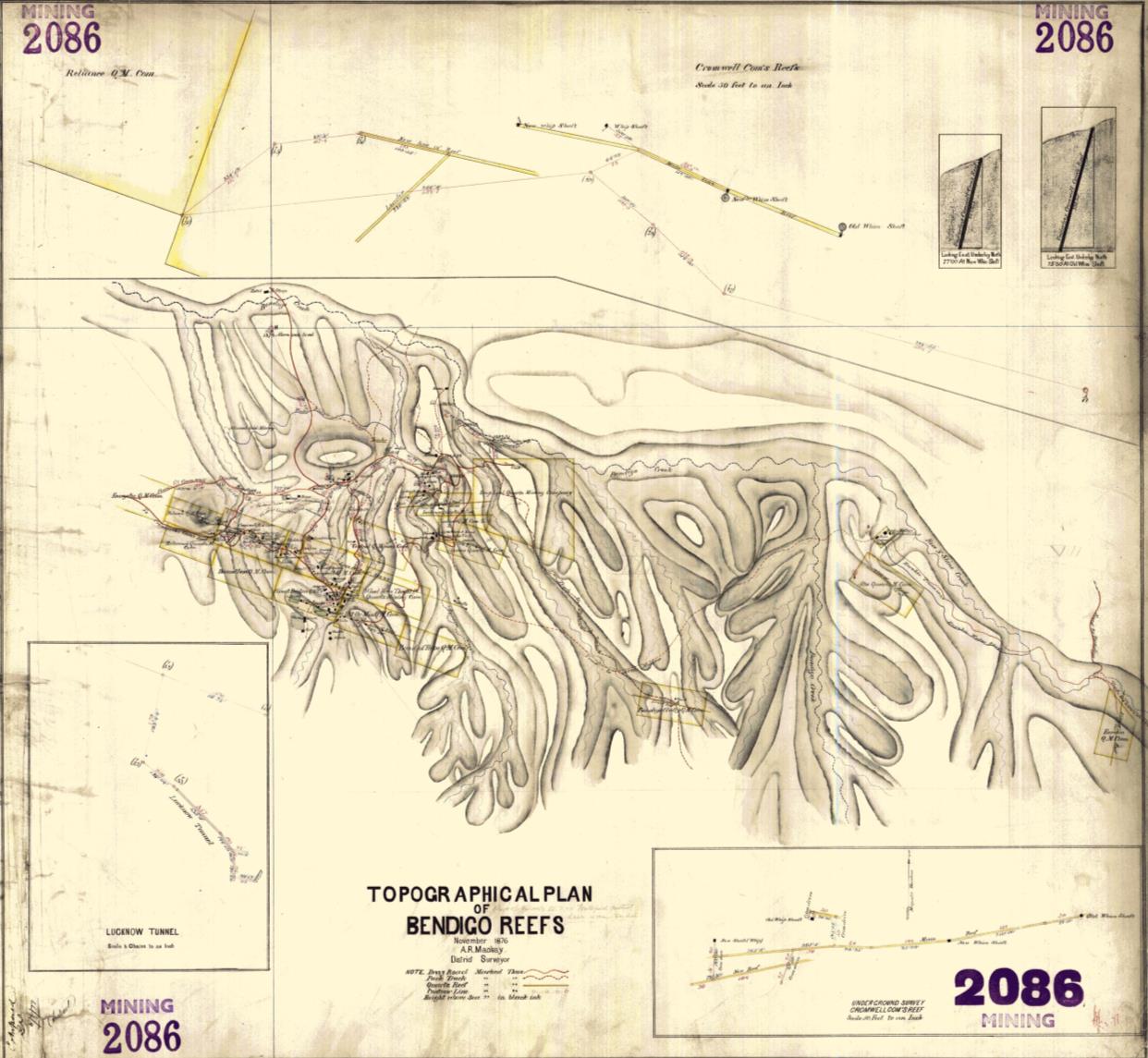
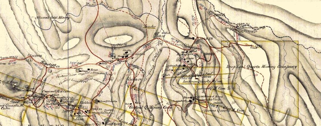
 Figure 3. 1876 survey plan of the project area (SO 2086), red box indicated the plan detail below.
Released under the Official Information Act
Figure 4. Detail of the 1876 survey plan above, showing Logantown.
8

s9(2)(ba)(i), s9(2)(b)(ii)
9
Released under the Official Information Act

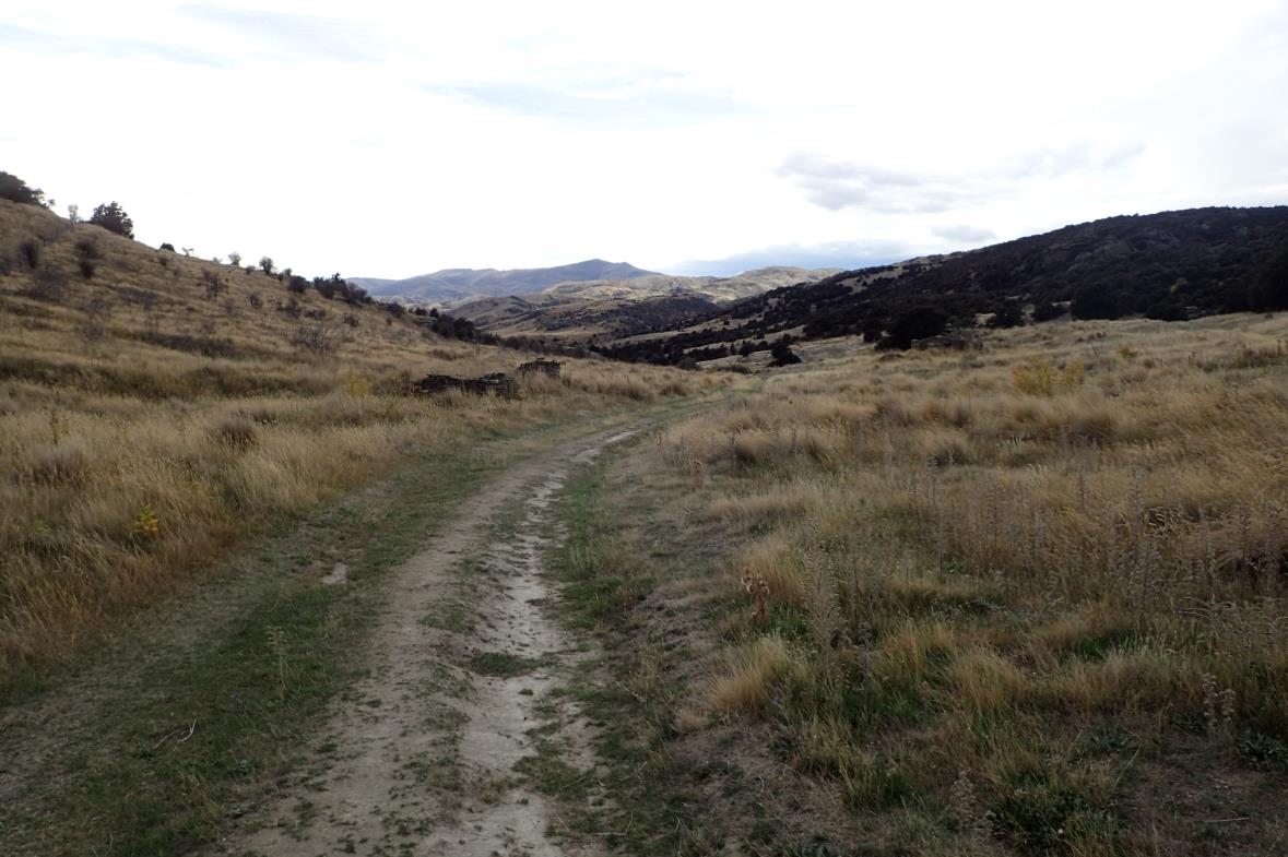
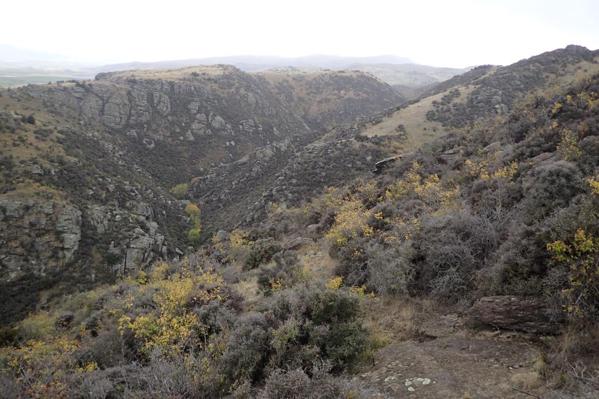 Figure 6. General landscape and vegetation across the proposed track.
Released under the Official Information Act
Figure 7. Looking east towards section of proposed track that could not be surveyed.
10

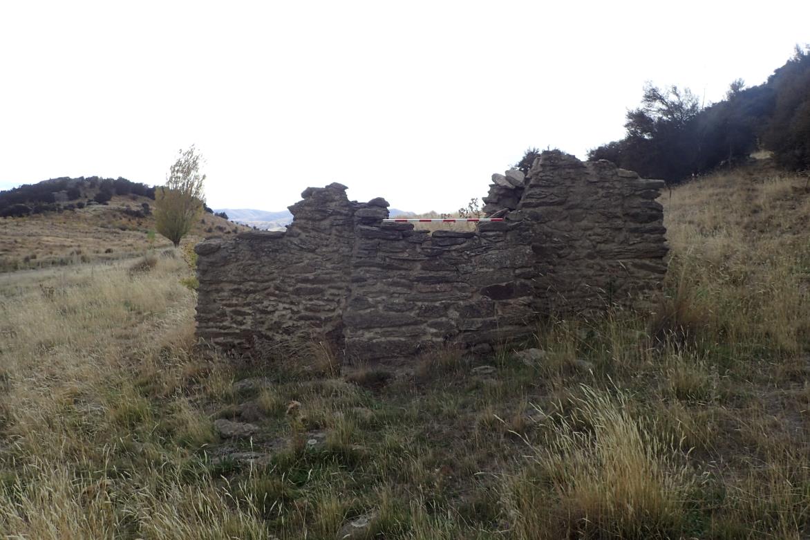
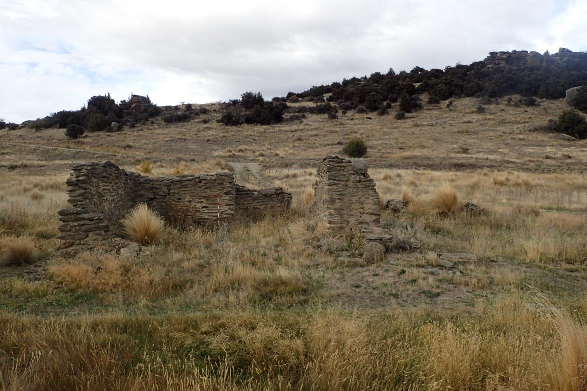 Figure 8. G41/341, facing east.
Figure 9. G41/336, facing north.
Figure 8. G41/341, facing east.
Figure 9. G41/336, facing north.
Released under the Official Information Act
11

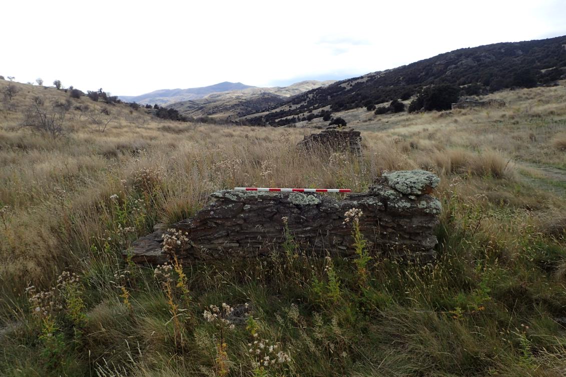
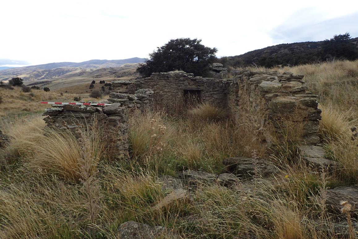 Figure 10. G41/337, facing east.
Figure 11. G41/791, facing east.
Figure 10. G41/337, facing east.
Figure 11. G41/791, facing east.
Released under the Official Information Act
12

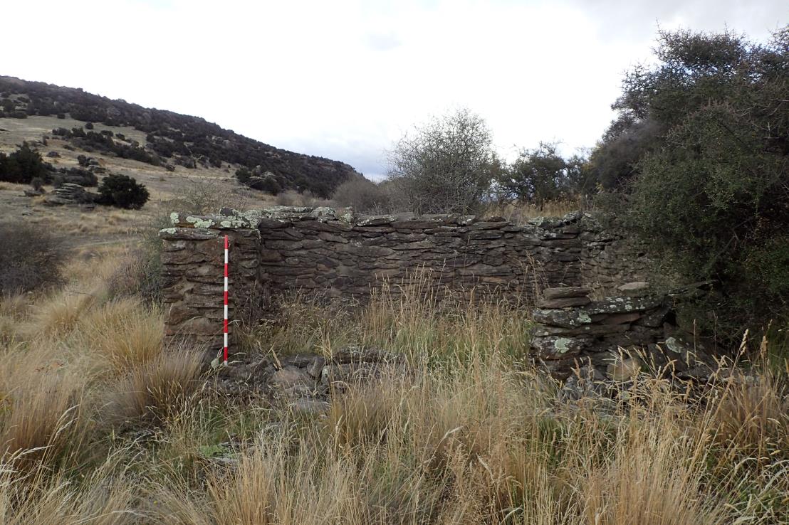
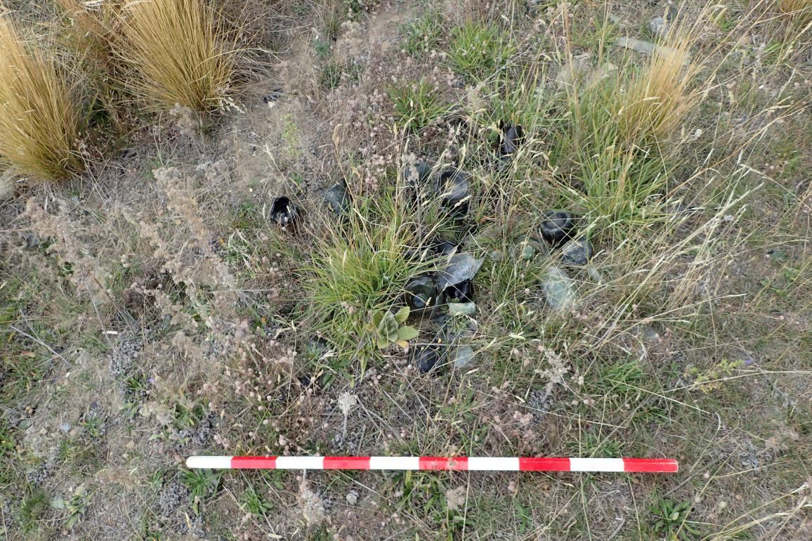 Figure 12. G41/345, facing west.
Figure 13. Fossicking dump, facing west.
Figure 12. G41/345, facing west.
Figure 13. Fossicking dump, facing west.
Released under the Official Information Act
13

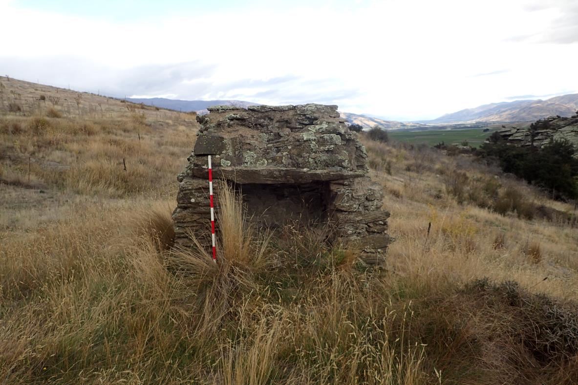
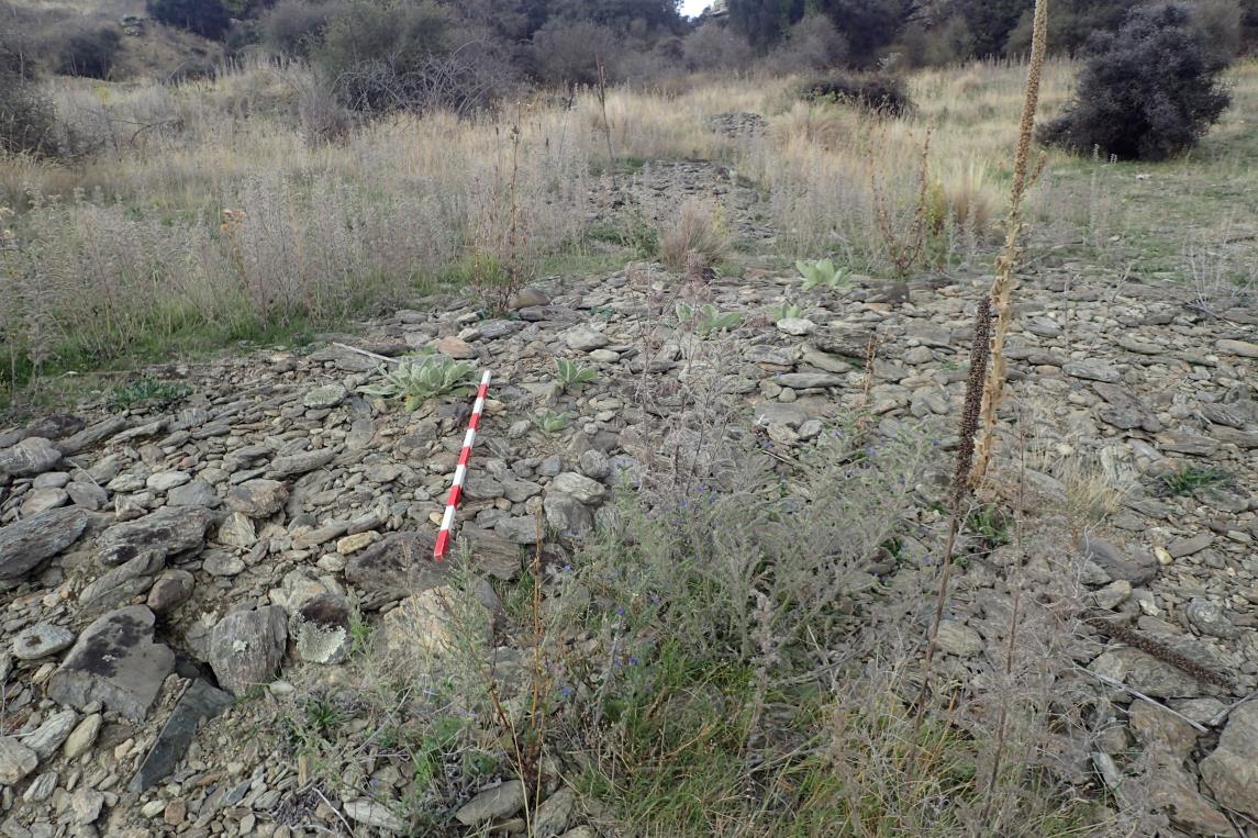 Figure 14. G41/348, facing south.
Figure 15. G41/313, facing north.
Figure 14. G41/348, facing south.
Figure 15. G41/313, facing north.
Released under the Official Information Act
14

 Figure 16. G41/355, facing west.
Figure 17. G41/239, facing west.
Figure 16. G41/355, facing west.
Figure 17. G41/239, facing west.
Released under the Official Information Act
15
Groundwater Effects Assessment
Gw_Effects_Rpt-Z24002BOG-1(FINAL).pdf
Purpose
To evaluate the potential groundwater-related environmental effects of the proposed Bendigo–Ophir Gold Mine Project in Central Otago, supporting
resource consent applications under the Resource Management Act 1991.
Findings
- The project involves open-pit and underground mining at three gold deposits: Rise & Shine (RAS), Come In Time (CIT), and Srex (SRX).
- The Bendigo Aquifer is identified as a sustainable water source, with high permeability and strong hydraulic connection to the Clutha River / Mata Au.
- Groundwater inflows to pits and underground workings are predicted, with surface water depletion effects on nearby creeks (e.g., Shepherds Creek).
- Water quality monitoring shows elevated levels of metals/metalloids in schist groundwater, with potential ecological risks.
- Groundwater modelling confirms that proposed abstraction and dewatering are within sustainable limits and regional policy thresholds.
Recommendations/
- Reuse of mine water for dust suppression and processing to reduce reliance on clean water.
Mitigations
- Monitoring programs for groundwater levels, chemistry, and surface water flows.
- Post-closure management includes pit lake formation, passive water treatment, and controlled discharge to creeks.
- Contingency planning for solute accumulation in downstream aquifers, including Managed Aquifer Recharge or alternative water supply.
Released under the Official Information Act
Groundwater Bore Take Assessment (SM)
Gw_Take_Effects_Rpt-Z24019SML-3 FINAL
Purpose
This is an assessment of mine bore water supply effects, plus providing key inputs to other experts work including mine planning, and environmental
geochemistry modelling undertaken separately by Mine Waste Management (MWM) to determine solute concentrations and mitigation.
Findings
Overall, the proposal for a bore field in the current location at a maximum rate of 110 litres per second is assessed to have environmental effects in
terms of groundwater levels, surface water depletion and groundwater resource allocation that are less than minor.
The water supply is required for potable water, makeup process water and dust suppression over disturbed surfaces such as haul roads.
The peak water supply requirement of the proposed mining complex is estimated to be 110L/s
The water table is 20m below ground
High permeability and strong connection of the Bendigo Aquifer to sources of recharge means the substantive drawdown effect is restricted and the
projected drawndown effects on the nearest neighboring water bore was less than 0.85 metres.
The proposed groundwater taking from the bore field would increase the net depletion effect on the Clutha River / Mata Au but would fall within the
bands of sustainable allocation for the Bendigo Aquifer or future limits for the Clutha River / Mata Au.
There is also adequate natural water to be allocated to the proposed water take within allocation limits
Recommendations/
• Opportunities exist for the aggregate effects of taking groundwater at the MGL bore field being lessened through water conservation and water
Mitigations
source substitution
• Monitoring opportunities exist for ensuring that actual effects intensities are no more than predicted intensities of effects, including metering of
groundwater abstraction rates and volumes, and monitoring of surrounding groundwater level in the Bendigo Aquifer at up to three separate
locations.
Released under the Official Information Act
Groundwater Modelling Analysis (SM)
hardrock_bog_report_2025_05_12 FINAL
Purpose
Understand flow of water within the hardrock aquifer, and therefore the potential impacts of dewatering for pit construction and operation.
The report was undertaken to perform the following key actions regarding the potential mining operation.
1. Develop a conceptual model of the hydrogeological environment in the proposed mining area
2. Estimate the pre-mining water table
3. Assess the likely impacts of the proposed mining activities on the groundwater system in the area including the potential downstream
impacts on surface water features
4. Predict the likely rate of de-watering required for the open cast mining activities.
Findings
The ground has been modelled in two components
- A thin veneer "aquifer" made up of soil and weathered rock. It has been assumed that this layer is thin, and due to the steep slope there is
limited water holding capacity
- A hard rock aquifer - Modelled as three zones – TZ3, TZ4 and RSSZ
The models found:
- Approx 36.5mm per year recharge into the hard rock aquifer – less than 10% of rainfall
- RSSZ – high permeability, due to fractured nature
- TZ4 was found to have low permeability
Rise and Shine
- Two sources of water flowing into the pit
Rainwater – through surface veneer "aquifer". At an annual average of 9L/s, however, in reality this will be variable and "flashy"
during periods of high rainfall
Groundwater (hard rock aquifer) into the pit at a max of 5L/s
- Activities are unlikely to significantly reduce the flow of Shepherds Creek - no more than 9 L/s of reduced flow. Much of this reduction is not
due to groundwater loss, but because the new pit will capture some of the surface water that would have normally flowed into the creek.
Released under the Official Information Act
Groundwater Modelling Analysis (SM) cont.
hardrock_bog_report_2025_05_12 FINAL
Findings cont.
Come in Time
- Mining pit won't directly lower the water level in Shepherds Creek. Any reduction in the creek's flow will likely be due to the pit diverting
some of the rainwater that would normally have seeped into the ground and eventually made its way to the creek
- TZ-3 Schist near the surface had a similar water flow rate to a fractured rock zone called the RSSZ. The scientists believe this is because
the TZ-3 Schist in that area is also fractured, likely due to its closeness to the RSSZ.
- Water lost from the creek will be relatively small, no more than 15.7 L/s. Similarly, the amount of groundwater flowing into the pit will also
be small, not exceeding 3.5 L/s.
SREX
- The model found that the TZ-3 Schist and RSSZ have similar hydraulic conductivity, where other modelling predicted the TZ-3 to be less
permeable. It is likely this is due to TZ-3 in this area being more fractured, due to its proximity to the RSSZ.
Released under the Official Information Act
Noise & Vibration Assessment (SM)
Rp 001 R02 20230685 Bendigo-Ophir Gold Project- Assessment Of Noise Effects _ FINAL.pdf
Purpose
Assessment of the potential noise and vibration effects from the proposed BOGP located in Central Otago.
This report provides:
• An overview of the proposed mining activity with respect to noise generation;
• A review of applicable noise assessment criteria;
• A description of the existing noise environment;
• Predicted noise levels from the proposed mining activity;
• Predicted noise levels during the construction phase;
• An assessment of the potential noise effects at nearby noise sensitive receivers;
• A review of blasting noise (overpressure) and vibration; and
• Recommendations for the management of noise for the future life of the mine.
Findings
Assessment found that operational noise from the proposed BOGP will be minimal in the context of the existing rural residential noise environmental
and what can be reasonably anticipated by the Distrct Plan permitted activity noise limits.
The large distances between primary noise sources and sensitive receivers, combined with the natural screening effects provided by the terrain, means
that activity noise levels will comply with the Central Otago District Plan (CODP) permitted activity noise limits at the closest residential receivers. On
site construction noise and blasting activities are also expected to comply with CODP permitted activity standards.
Recommendations/
Recommended consent conditions include:
Mitigations
1. Noise limits that reflect the CODP numerical values but with updated metrics and Standards to reflect current best practice
2. Blasting noise (overpressure) and vibration limits to reflect current best practice
3. The requirement of a Noise and Vibration Management Plan to manage the day-to-day noise and vibration emissions at the mine, including a
procedure for handling complaints
4. A requirement that the best practicable option is adopted on site to minimise noise at all times.
Released under the Official Information Act
Exterior Lighting Report (SM)
CQ24020 BOGP Exterior Lighting Report Rev C FINAL.pdf
Purpose
Review, provide comment and expert advice regarding the mitigation and effects of exterior lighting anticipated to be included within the proposed
BOGP. This report shall support the overall assessment of environmental effects, to be submitted within the application for resource consent.
Findings
This report concludes that the current mandatory requirements for compliance with the District Plan relate only to light spill limits, which will be
achieved through the proposed conditions to mitigate lighting effects.
Exterior lighting is required for the practical and safe establishment and operation of buildings and equipment associated with the project. This report
identifies a number of mitigating factors that can be employed to minimise the environmental impacts of exterior lighting, with consideration of spill
light towards boundaries and neighbouring properties as well as upward spill light towards the night sky.
Consent conditions for the project should ensure that compliance with the District Plan is achieved as
per Rule 12.7.6 which states:
“No activities shall result in greater than 10 lux spill (horizontal and vertical) of light onto any adjoining property or road, …The amount of light that may
be spilled onto a neighbouring property may be increased by not more than 100%, in cases where the activity on that neighbouring property is not
residential.”
Recommendations/
• Finalise building, plant and process area layouts for the project area, which shall be used to finalise exterior lighting locations
Mitigations
• Consultant to complete preliminary lighting layouts and calculations/modelling for each area in accordance with lighting requirements
• Consultant to finalise lighting layouts and calculations/modelling including light fitting specifications for each area to ensure that lighting is suitable
for MGL operations and to demonstrate that the design complies with agreed lighting requirements
• Procure and install lighting on site, in accordance with final detailed design
• Consultant to provide assistance with review/commissioning of on-site lighting installation as required
Released under the Official Information Act
Surface Water Effects Assessment (SM)
Surface_Water_Effects_Rpt-Z24002BOG-2 (FINAL).pdf
Purpose
Assessment of the effects on the flow or volume of surface water and provides key inputs to other
experts work including aquatic ecology, wetlands and environmental geochemistry modelling undertaken by
others.
Findings
This assessment concludes the abstraction, diversion, use and return of surface water with the
proposed mitigations will result in an acceptable outcome.
• The surface water comprises creeks draining the Dunstan Mountains into the Lindis River (a tributary of the Clutha) and the Clutha River / Mata Au main stem. The
hydrology of Shepherds and Rise and Shine Creeks were previously ungauged, continuous measurements have been taken since late 2022.
• Mining plans to store overburden and extract ore in Shepherds and Rise and Shine creek catchments.
• Across the three pits, water management would be established in order to intercept or retain stormwater, other mine-impacted water and shallow groundwater
seepage from entering downstream natural water during the operational phase of the mine site.
• These would reduce the natural flow rates of Shepherds Creek and Rise and Shine Creek during the operational phase of active mining.
• At its full extent the RAS pit will extend through a short reach of RAS Creek, it is proposed to construct a culvert sized to carry normal flow and maintain continuity
into Bendigo Creek. In periods of high flows, the stream would overtop the structure and water would overflow into the pit.
• Artificial drainage paths would be left in the wake of mining operations into the post-closure period.
• SRX pit dewatering would briefly draw off a significant portion of creek flow passing the immediate vicinity of the pit’s northwest corner in the latter operational
stages of mine life, although upstream diversions above the SRX pit would preserve the bulk of upper Rise and Shine Creek flows. This creek is a small tributary
among much larger Bendigo catchment tributaries. The loss of Rise and Shine flood flows, which could not pass the straddle culvert to the RAS pit sump, would be
of low impact.
• The active closure and post-closure creek network would be significantly restored to their former hydrological function, with the exception of the RAS pit lake and
drainage to lower Shepherds Creek through flooded underground workings, altered former ELF and TSF substrates, and the former SRX pit lake.
• Post-closure catchment hydrology for both Shepherds and Rise and Shine Creeks would be affected by the change in substrates and retention of soil moisture,
resulting in higher catchment flow yields and more stable creek flow. Long-term this would be a beneficial outcome for creek hydrology in a water-short part of
Otago.
• Project water supply groundwater pumping would affect the flows of the Clutha River / Mata Au and Lake Dunstan, but in comparison to large available flows and
surface water allocation in the main stem, the groundwater depletion effect would be inconsequential.
Released under the Official Information Act
Native Bat Survey
20250515_BOGP_Native_Bat_Survey_Final_v001.pdf
Purpose
To assess the presence of native bat species within the Bendigo–Ophir Gold Project (BOGP) Ecological Study Area (ESA) and determine whether
proposed mining activities could impact bat populations. The survey supports the project's Assessment of Environmental Effects (AEE).
Findings
- No native bats detected: Acoustic monitoring and a review of the Department of Conservation’s National Bat Database found no evidence of long-
tailed (Chalinolobus tuberculatus) or lesser short-tailed (Mystacina tuberculata) bats within the 5,000 ha ESA.
- Habitat limitations: The ESA lacks old-growth indigenous forest and has limited suitable roosting habitat. While some mature exotic trees and
wetland areas exist, they are not sufficient to support regular bat activity.
- Survey coverage: 28 Automatic Bat Monitors (ABMs) were deployed across two survey rounds (Nov–Dec 2023 and Mar–Apr 2024), covering 1,111
valid survey nights.
- Zero bat passes recorded: No bat echolocation calls or feeding buzzes were detected during the entire survey period.
Recommendations/
- No further bat-specific mitigation required: Given the absence of bat activity and suitable habitat, the report concludes that further consideration of
Mitigations
bat-related effects is not warranted in the BOGP consent process.
- General ecological monitoring may continue as part of broader biodiversity management, but bats are not considered a constraint to the project.
Released under the Official Information Act
Bond Introduction
Matakanui Bond Introduction-e.pdf
Purpose
To provide a preliminary assessment of the rehabilitation bond required for the Bendigo–Ophir Gold Project, ensuring that sufficient financial resources
are available to cover site rehabilitation and aftercare in the event Matakanui Gold Ltd is unable to complete these obligations. The bond is intended to
be held jointly by relevant regulators (Otago Regional Council, Central Otago District Council, and potentially the Department of Conservation).
Findings
- The bond covers:
• Closure works: demolition, landform recontouring, soil replacement, revegetation.
• Aftercare: vegetation maintenance, weed control, water treatment, and monitoring.
• Environmental offsets: long-term management of ecological areas (e.g. Bendigo and Ardgour).
- The bond is reviewed annually and adjusted based on the mine’s development stage.
- Estimated bond values range and peak in Year 5, then gradually decrease as rehabilitation progresses.
- The bond includes conservative assumptions, such as full ecological programme costs and maximum disturbance areas.
- No acid-generating rock is expected, but low-permeability covers are assumed to mitigate potential leachate risks.
Recommendations/
-
Annual bond reassessment: Required to reflect actual site disturbance and rehabilitation needs.
Mitigations
-
Joint regulator oversight: Ensures efficient use of funds and coordinated response if the bond is called.
-
Inclusion of ecological offset costs: Covers up to 30 years of habitat management.
-
Exclusion of risk contingency: No risk cost included yet; future assessments may add this based on geotechnical or environmental risks.
-
Post-closure monitoring: Three years of water and vegetation monitoring assumed, with five years of aftercare.
Released under the Official Information Act
Air Quality Assessment
Air Quality C051440001R003.pdf
Purpose
To evaluate the potential environmental and health effects from dust and gaseous emissions associated with the proposed gold mining operations, and
to recommend appropriate mitigation and monitoring measures.
Findings
- Dust and gas emissions will occur from mining activities, haul roads, stockpiles, processing plant, and underground operations.
- Health and ecological risks are considered negligible or less than minor due to:
• Effective mitigation strategies.
• Significant buffer distances to sensitive receptors.
• Low frequency of high-risk weather conditions.
Recommendations/
- Implement a comprehensive Air Quality Management Plan.
Mitigations
- Apply best practice dust and gas suppression techniques.
- Monitor emissions and weather conditions.
- Ensure consent conditions clearly define permitted activities, performance standards, and response protocols.
Released under the Official Information Act
Bendigo-Ophir Gold Project Mine Closure Plan
J-NZ0454-002-R-Rev1-MCP.pdf
Purpose
The Mine Closure Plan outlines how Matakanui Gold Ltd (MGL) intends to responsibly close and rehabilitate the Bendigo–Ophir Gold Mine in Central
Otago once mining operations end. It supports environmental approvals under the Fast-track Approvals Act 2024 and guides planning for:
- Safe closure of mine pits and infrastructure
- Restoration of the land for future use
- Protection of water, soil, and cultural heritage
- Ongoing monitoring and stakeholder engagement
Findings
Mine Life: The project is expected to operate for 31 years, including construction, mining, closure, and post-closure monitoring.
Mining Areas: Four gold deposits will be mined
Land Use: Most of the land is currently used for farming. After mining, the land will be returned to pastoral use with some areas set aside for ecological
restoration.
Environmental Risks:
- Water: Mining may affect groundwater and surface water quality.
- Soil: Some soils will require careful management.
- Drainage: There is a risk of neutral metalliferous drainage (NMD), which could affect water quality.
Cultural and Heritage Values: The area includes significant Māori and European heritage sites. These will be protected during closure.
Stakeholder Engagement: Local communities, iwi, and government agencies have been consulted and will continue to be involved throughout the life
of the mine.
Recommendations/
Land Rehabilitation:
Mitigations
- Waste rock will be stored in engineered landforms (ELFs) designed to be stable and blend into the landscape.
- Pits will be backfilled or turned into lakes, with safety barriers to prevent public access.
- Tailings (fine waste) will be stored in a dam built to national safety standards and capped with clean soil.
- Revegetation will use native and pasture species, with trials to ensure success.
Released under the Official Information Act
Bendigo-Ophir Gold Project Mine Closure Plan cont.
J-NZ0454-002-R-Rev1-MCP.pdf
Recommendations/
Water Management:
Mitigations cont.
- Water quality will be monitored regularly.
- Passive treatment systems (like wetlands) will be used to clean water before it enters creeks.
- Groundwater and surface water will be tested to ensure contaminants stay within safe limits.
Contaminated Sites:
- Contaminated areas will be assessed and either cleaned up or managed safely.
- A contaminated sites management plan will be developed before closure.
Monitoring and Maintenance:
- Closure monitoring will continue for at least 11 years after mining ends.
- This includes checking water quality, land stability, vegetation growth, and heritage protection.
Community and Workforce:
- A strategy will be developed to support workers affected by mine closure.
- Public access routes will be maintained or realigned in consultation with landowners and communities.
Legal Compliance:
- Closure will follow all relevant laws, including the Resource Management Act, Crown Minerals Act, and Heritage New Zealand Pouhere Taonga Act.
- Financial bonds will be provided to ensure closure obligations are met.
Released under the Official Information Act