

 Memorandum
SUBJECT
Traffic Modelling - The Strand SVL
PREPARED BY
section 9(2)(a)
DATE
31 Mar 2023
1 INTRODUCTION
ACT 1982
Waka Kotahi have prepared a new design for The Strand that includes a Special Vehicle Lane
(SVL) in each direction, a shared walking/cycling path, three additional midblock signalised
pedestrian crossings over The Strand, one new signalised crossing over Gladstone Road and
numerous other new signalised and raised pedestrian improvements.
This memo provides a summary of the traffic modelling of this proposed design.
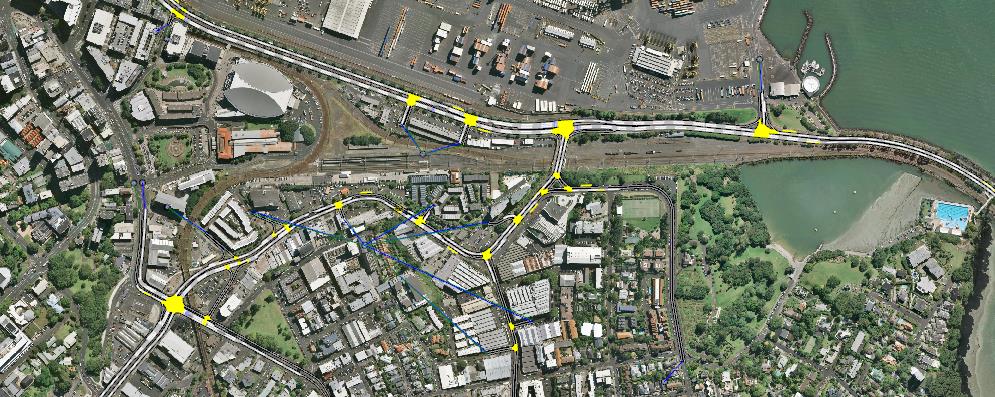
2 TRAFFIC MODEL
A traffic model was developed in 2019 to assist with the integration of the Tamaki Dr cycleway
improvements and earlier options for The Strand. A detailed overview of the model is provided
INFORMATION
in the AFC modelling memo dated 14 August 2019.
The model uses the Aimsun microsimulation software, allowing detailed analysis of individual
vehicle movements and the interactions between closely spaced intersections.
There are the morning and evening commuter peak models. The model extent is shown below.
RELEASED UNDER THE OFFICIAL
Traffic Modelling - The Strand SVL
1
31 Mar 2023


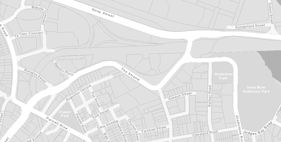
 3 DESIGN OVERVIEW
An overview of the main changes around The Strand road corridor with the proposed design
is provided below. These are the features of the design that have been input into the traffic
model.
1982
Existing
ACT
Special Vehicle Lanes
pedestrian
crossing
New signalised
pedestrian crossings
INFORMATION
4 MODELLING
4.1 SVL Options
Two options have been modelled for the SVL, ‘Bus and Freight’ or ‘T2 and Freight’. Other
aspects of the design remain consistent between modelled options.
OFFICIAL
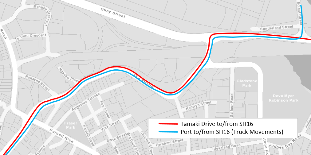
4.2 Travel Times
THE
The key performance outcomes extracted from the traffic model are the travel times for
private vehicles and freight along The Strand. The routes used in the travel time analysis are
shown below.
UNDER
RELEASED
Traffic Modelling - The Strand SVL
2
31 Mar 2023

 4.3 Model Results
The travel times are presented below for the existing layout along The Strand and the
proposed design for each SVL Option. Shading is used to categorise the changes in travel
time from the existing layout, with red showing a worsening in travel time, green an
improvement, and darker and lighter shades being higher or lower change.
Car Travel Times (mins)
T2/Freight SVL
AM Peak Hour
Existing Layout
Bus/Freight SVL
T1
T2
1982
SH16 to Tamaki
4.5
5.6
5.7
4.8
Tamaki to SH16
8.6
13.6
9.8
8.0
ACT
PM Peak Hour
Existing Layout
Bus/Freight SVL
T1
T2
SH16 to Tamaki
4.5
6.9
6.5
5.6
Tamaki to SH16
7.7
9.5
9.8
6.5
Truck Travel Times (mins)
AM Peak Hour
Existing Layout
Bus/Freight SVL
T2/Freight SVL
SH16 to Port - Trucks
4.4
5.0
4.9
Port to SH16 - Trucks
7.5
7.2
5.8
PM Peak Hour
Existing Layout
Bus/Freight SVL
T2/Freight SVL
SH16 to Port - Trucks
4.6
5.8
5.2
INFORMATION
Port to SH16 - Trucks
8.0
7.0
6.9
The modelling shows that the Bus/Freight SVL option provides some benefit for Trucks from
the Port to SH16, but is providing worse outcomes towards the Port. The SVL is having a
significant negative impact on general traffic, with travel times increasing by 1-5 minutes, and
this is offsetting some of the intended benefits of the SVL in both directions.
OFFICIAL
The T2/Freight SVL option improves travel times for Trucks, with a reduction in travel time of
1-1.5 minutes towards SH16. A similar benefit of around 1 minute is predicted for T2 vehicles.
THE
However, in the other direction towards the Port, all vehicles are predicted to experience
additional delay of up to 1 minute in comparison with the existing situation. There are two
issues in this direction. Firstly, the three additional pedestrian crossings add some delay. The
second issue is that the SVL towards the Port terminates with an extra merge prior to St
Georges Bay Road, adding another point of delay in comparison with the existing layout where
UNDER
all traffic has previously merged after the Parnell Road/Beach Road intersection.
4.4 Sensitivity
4.4.1 Pedestrian Demand
The model assumes that a pedestrian will call each of the new signalised crossings during
each 120 second signal cycle. This is true of the single existing crossing on The Strand, but
RELEASED
this pedestrian demand may get dispersed among the four crossing points and result in less
frequent demand per crossing at times.
The model has been used to test the sensitivity of the outcomes to the pedestrian frequency
at these new signalised crossings.
Traffic Modelling - The Strand SVL
3
31 Mar 2023


The travel times are presented below for the T2/Freight SVL option, with full pedestrian
frequencies, half frequencies and no demands.
Pedestrian Sensitivity Testing, T2 Travel Times (mins)
AM Peak Hour
Existing Full Peds Half Peds No Peds
SH16 to Tamaki
4.5
4.8
4.3
4.1
Tamaki to SH16
8.6
8.0
6.4
5.9
1982
PM Peak Hour
Existing Full Peds Half Peds No Peds
SH16 to Tamaki
4.5
5.6
5.0
5.0
Tamaki to SH16
7.7
6.5
6.3
6.5
ACT
This testing shows:
• With each pedestrian crossing called every 120 second cycle, T2 are predicted to
have a reduction in travel time of 30-70 seconds in the more congested direction
towards SH16. However, travel times towards Tamaki Dr are predicted to be 20-60s
longer than existing for T2 vehicles with the new design.
• Not running the pedestrian crossing at all shows that providing only the SVL improves
travel times in the more congested direction towards SH16 by 1.2-2.7 minutes.
However additional delays of up to 30 seconds are still predicted towards Tamaki Dr.
INFORMATION
• If the crossing is called only 50% of the time the impact is similar to if the crossings
are not called at all.
4.4.2 Critical Pedestrian Crossing
Reviewing the performance of the T2/Freight SVL option in detail, the majority of the additional
OFFICIAL
vehicle delay is experienced at the new signalised crossing located adjacent to the St Georges
Bay Road intersection. The reason is that in both directions there is only a single lane at the
stopline at this crossing, and therefore queues quickly extend back. Also, significantly, heading
THE
towards the Port the queue goes back into the T2 lane and disrupts the merge at the
termination of the T2 lane, more severely impacting T2 vehicles.
An option was modelled where this single crossing was removed but all other remained and
were called every signal cycle. The model results are provided below and compared with the
option including all crossings and the option with no new pedestrian crossings.
UNDER
Remove Crossing Option, T2 Travel Times (mins)
Remove
AM Peak Hour
Existing Full Peds No Peds Crossing
SH16 to Tamaki
4.5
4.8
4.1
4.2
Tamaki to SH16
8.6
8.0
5.9
7.1
Remove
PM Peak Hour
Existing Full Peds No Peds Crossing
RELEASED
SH16 to Tamaki
4.5
5.6
5.0
5.1
Tamaki to SH16
7.7
6.5
6.5
6.4
This shows that removing this crossing eliminates the majority of the additional delay
associated with the new signalised crossings, reducing travel times by up to 1 minute.
Traffic Modelling - The Strand SVL
4
31 Mar 2023

 5 SUMMARY
5.1 Bus vs T2 SVL
Providing a Bus/Freight SVL is predicted to have a significant negative impact on general
traffic, with travel times increasing by up to 5 minutes from Tamaki Dr to SH16. This is offsetting
the benefits of the SVL for freight and providing worse outcomes than the existing situation.
The T2/Freight SVL improves travel times for Trucks, with a reduction in travel time of 1-1.5 1982
minutes towards SH16.
However, T2 and Freight are still predicted to experience additional delay of 0.5-1 minute
towards the Port. The three additional pedestrian crossings add some of this delay. The second
ACT
issue is that the SVL towards the Port adds another point of delay where the SVL terminates
with a merge prior to St Georges Bay Road.
5.2 Signalised Pedestrian Crossings
With the proposed design including three new signalised pedestrian crossings over The
Strand, the improvements for freight will be sensitive to pedestrian demands.
If the new pedestrian crossings are not utilised at all, providing the T2/Freight SVL improves
travel times in the more congested direction towards SH16 by 1.2-2.7 minutes, an
INFORMATION
improvement of up to 2 minutes in comparison with the outcome where all crossings were
fully utilised.
If each new pedestrian crossing is called only 50% of the time the outcome is predicted to be
similar to the situation where they are not called at all.
Additional delays of up to 30 seconds are still predicted towards Tamaki Dr due to the
OFFICIAL
additional point of delay where the SVL terminates with a merge.
The new pedestrian crossing that has the biggest impact on vehicle travel times is the one
THE
provided adjacent to the St Georges Bay Road intersection, where only a single traffic lane is
available at the stopline. This results in queues extending quickly and impacting T2 and freight
not just the general traffic. This specific crossing accounts for the majority of the additional
delay when all crossings are fully utilised.
UNDER
RELEASED
Traffic Modelling - The Strand SVL
5
31 Mar 2023