
!
(
Cliff Rd
!
(
!
( !
(
!
(!
(
!
(
Vale Rd
!
(
!
(
!
(
!
( !
(
!
(
!
(
!
(
!
(
!
(
T
!
(
u
!
(
ru
Long Dr
a
!
(
!
(
!
(
S
!
(
t
!
(
H !
(
anene St
!
(
aved: 22/03/2019
!
(
Tamaki Dr
!
(
!
(
ate S
xd D
!
(
!
(
!
(
M
G
a
eliers_20190321.m
o
h
l
ek
!
( !
(
d
AS\StH
i
e
!
(
e
S
St
!
( !
(
!
(
t
!
(
aps\20190314_C
!
(
Polygon Rd
St
IS\02_M
Kot
!
(
iri St
T
H
!
(
h
e
Devore St
A
e
li
e
ork Area\4.99 G
u
P
r
!
(
c
a
s
k
r
a
B
ata St
la
d
a
T\4. Tech w
M
n
e
y
G
d
R
R
d
Keys Tce
Tuhim
d
C
Benbow St
h
P:\605X\60582275\M
ale
!
(
ng
!
(
er
!
(
S
!
(
t
!
(
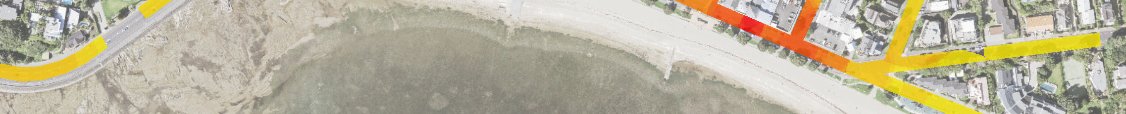
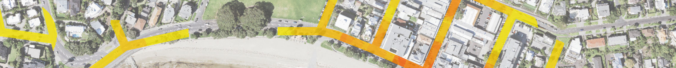
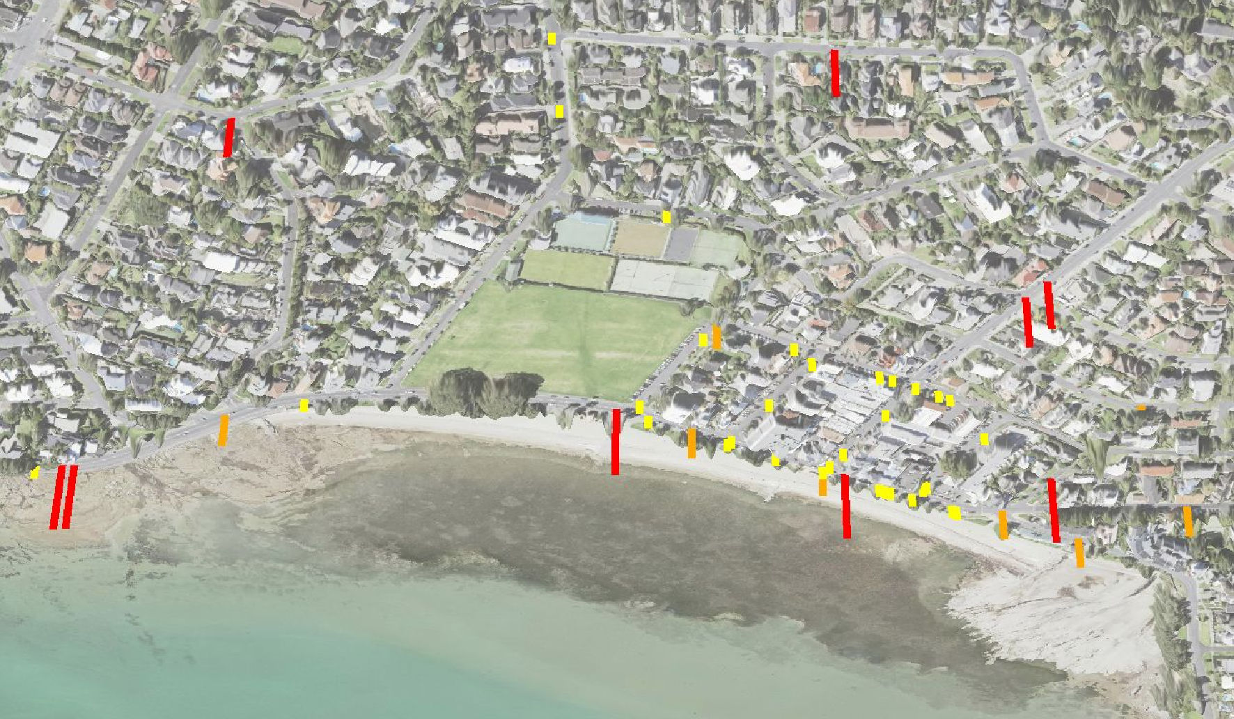
CAS - Crash Severity ( 2013 -2018 )
Reported Crash Locations
!
( Serious !
( Injury !
( Non Injury
Meters
Source: 0
50
100
150
200
St Heliers Town Centre
2013 - 2018
Relative Density - Crash per 50m