
8 July 2019
Leonie Exel
[FYI request #10577 email]
Dear Leonie
OFFICIAL INFORMATION REQUEST – USE OF THE TERM “PUBLIC ROADS NOT LEGAL” IN THE DOG
CONTROL BYLAW 2016
I am writing in response to your email of 20 June 2019, in which you request a reason for the use of
the reference “Public Roads not Legal, allowed on leash” in the Dunedin City Dog Control Bylaw 2016
maps, and any official documents about that category of road.
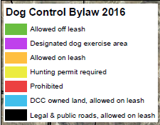
Your request notes that the roads are identified in the maps by a “black line” and that a number of
them are designated “Public Roads not Legal, allowed on leash”. We have reviewed the maps
available on the DCC website and note that the key/legend used for maps within the Dog Control
Bylaw 2016 (Schedule E, maps) is shown below.
In regard to the reference of a “legal road”, through maps located through the webapp viewer on the
Council website, as an example I can confirm that Magnet Street is not vested in the Council as a legal
road reserve, but is a route maintained for pubic to use as it is located within a reserve. The map label
is explaining that while the area is not road reserve, it is route available for public use. The wording
used in the map label is consistent with the definition of a road in Section 315 (1)(g) of the Local
Government Act 1974.
https://dunedin.maps.arcgis.com/apps/webappviewer/index.html?id=5e15eb292b164ea6a33b7f8bf
4295344
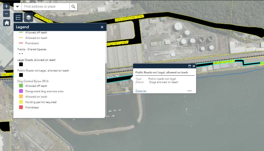

I acknowledge that interactive map legend differs from the bylaw map legend and that this GIS
discrepancy will be corrected as part of the next review of the Bylaw.
I hope that this clarifies the matter for you in regard to the reference of the use of “road” in the Dog
Control Bylaw 2016 maps.
Yours sincerely
Lauren McDonald
GOVERNANCE SUPPORT OFFICER